September 25, 2010. The Bearskin State Bike Trail runs for 18.2 miles from Minocqua, Wisconsin to County Highway K just south of Harshaw, roughly parallel to State Highway 51. Even though I used to live in Sugar Camp, perhaps twenty five miles to the east of this trail, I had never biked it before. This northeastern section of Wisconsin is chock full of lakes (and maybe nuts, too). Tourism and logging are top industries. It is a beautiful place, with lots of water and deep woods.
I stayed with a friend at her cabin near the town of Lake Tomahawk. We have an annual weekend trip which involves cooking, eating, hiking and lounging, and various forms of silliness. We also have a tradition of inventing martinis and naming them after where they were consumed.(Trampolini, anyone?) This time involved a delicious concoction that we named a Kayaktini. Guess where we enjoyed that! Don't worry, we wore flotation devices, and only had one Kayaktini. We're not stupid. (??)

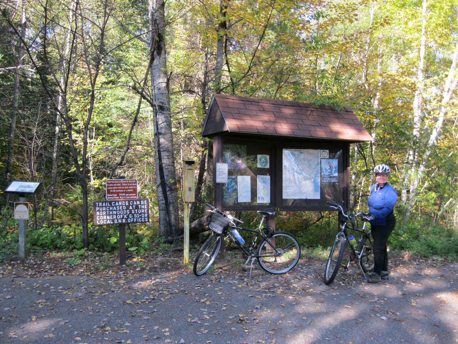
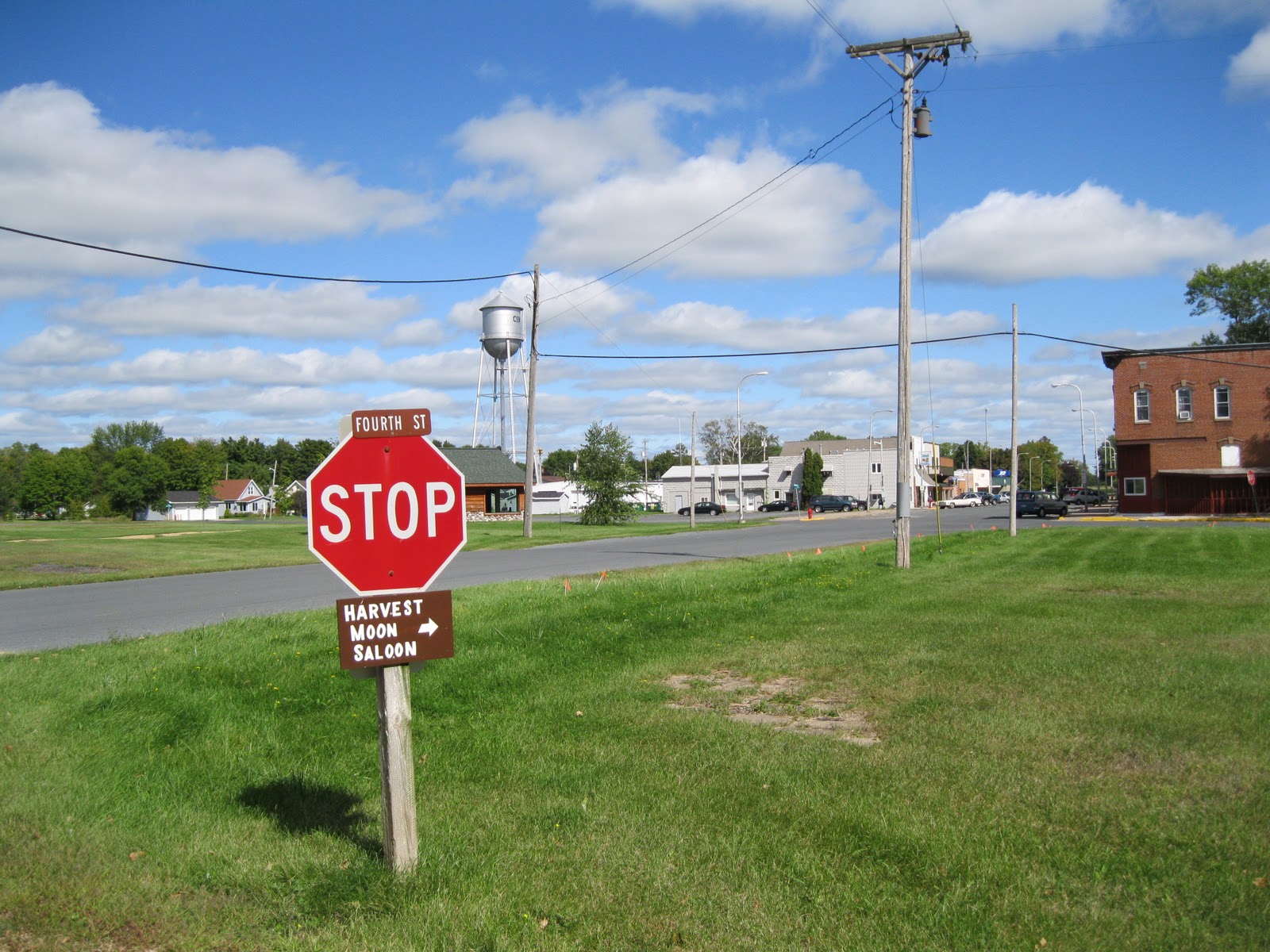
But back to biking. We didn't attend Beef-A-Rama. We drove into town on State Highway 51 to Front Street, and parked in the municipal parking lot behind the post office. With great luck, we had found a parking spot almost right away. After unloading the bikes and arranging our gear, we were off down the 18.2 mile trail. The day was overcast, but later cleared.
The trail is composed of crushed granite, not the usual crushed limestone. This can mean it does not get compacted as densely as limestone, but I didn't notice a problem.
And no worries about us exceeding the 15 mph speed limit. We didn't.
Please notice that there are PLENTY of places in Minocqua for visitors to amuse/feed/water themselves. This area abounds with resorts, hotels, cabins, restaurants, galleries and northwoodsy shops. My usual advice is always: use the facilities now.
This trail had the most lakes, streams and wetlands of any trail I had encountered so far. The fall color was not quite at peak yet, but it was lovely.
The trail had many historical signs. This one tells about Baker Lake and a local legend: "Along this trail is an old foundation. Local legend tells that this log house was home to a man who never wore shoes. He lived off the land and water, catching fish and hunting wild game. As progress came to the area, the man was moved to Minocqua by local people who cleaned him up, clothed him and shoed him. He died within a week, showing that progress was not made for everyone."
This black bump on a stump is a bear that someone carved. It marks a driveway that crosses the trail. It was (thankfully) the only bear we saw that day. I have read accounts from other bike blogs of bear sitings. Bears are everywhere, of course. We just usually don't see them, but I am sure they see us.
When driving northwoods roads, it is not farmers' tractors that you will encounter, but logging trucks instead. Off to the side of the trail was a logging storage site.
The trail was well marked with mileage notices. Several back roads cross the trail, but there were always warnings to stop ahead. Please observe those notices. Logging trucks are large.
Left here to Hazelhurst, about 0.2 miles. To the right, is the restaurant, Jacobi's. It just wasn't open as we were biking by. Looks quaint, doesn't it?
Later these trees will probably be golden and red.There was just a touch of it now.
The historical sign below describes the construction of State Highway 51. The highway begins 55 miles north of this spot, and continues south to New Orleans, Louisiana. I didn't know that! This highway is the main link to the north. Increased use of cars made the passenger railway line obsolete.
I did not realize that beavers made mistakes. Unlike humans, I imagined beavers to be beyond that. However, the sign below describes how beavers made a mistake.
Since you probably cannot read the fine print: This site is Rocky Run Springs to the left. The trail crosses it with a culvert underneath. To the right is Rocky Run Creek. (Run is a New England term for "small stream", so in this case, it is Rocky Creek Creek. Hmm.) Beavers plugged the culvert completely in the spring of 1984. The waters rose, threatening to wash out the rail bed, and rose so high that it flooded their lodge, and they abandoned it to build one on higher ground. The culvert was unplugged (by humans) and the waters receded to their present level. The sign shows various trains that used the tracks.
Mile 8! We were making progress! It actually didn't take so long to get to this point. Of course, all the photo taking and stopping to read signs slows it down, but increased enjoyment.
Definitely stop at the South Blue Lake Wayside. It's a lovely place to stop, and besides that, you'd better. You won't find another along the trail. The next "facility" would be the end of Bearskin Trail, or at Northwoods Country Store (where State Highway 51 and County K meet). Just so you know,after the end of the Bearskin Trail, it continues for 6 miles, but as the Hiawatha Trail. This will take you to Tomahawk. It is not maintained as a touring trail, so the surface is rougher. If you have a mountain bike you could continue on. We did not.
Above are the facilities. Neat, clean, use 'em. Or, as my mother used to call it: a "biffy". Where did that come from. On the other (west) side of the trail are some picnic tables, and a pretty view of South Blue Lake.
This whimsical bit of picnic table graffiti depicts a carefree kite flyer.
This photo shows a "weather report" from Oshkosh, Wisconsin. Always hazy there, apparently.
You will cross Bearskin Creek eight times. The bridges are fun to cross, and afford great views of marshes, birds, and tamarack trees.
One of the best things (besides the beautiful scenery) of this trail is all the historical signs with information about how things used to be, and the characters that made it happen. When I previously described this area as being chock full o' lakes (and nuts) I was accurate. This area seemed to attract (we shall politely say) the "independent minded". The above sign tells about the railroad line shed (built in 1888) that was maintained by the Mitten Brothers, who lived with their parents in Minocqua. They traveled on a hand pump car from the town to the shed, stayed overnight, and repaired any rail damage they saw. I imagine the Mitten Brothers huddled together in a bachelor bed with a rudimentary fire.
Above is a view from inside the shed. I am sure the Mitten Brothers kept it in better repair back in the day.
This was the only hill we encountered. It made for a bit of speedy fun. But then we had to go up again.
Some impressive puddles happened along this low lying area. The summer had been full of storms and much rain, so a little challenge was thrown into the biking mix. I didn't take photos of the two large puddles that we wheeled through. The ground was sufficiently firm that we didn't get stuck. Just keep pedaling on.
Do stop here, and descend to the observation deck. You will cross a branch of Bearskin Creek to view where it spreads out in a marshy area.
Trout fishing, anyone? I don't fish, but this looks like trout could lurk here.
If you are nice to the troll, she will let you pass.
The guard rail says: "Kilroy was here". Kilroy is a very well traveled person.
"Kilroy was here is an American
popular culture expression, often seen in
graffiti. Its origins are debated, but the phrase and the distinctive accompanying
doodle—a bald-headed man (possibly with a few hairs) with a prominent phallic
nose peeking over a wall with the fingers of each hand clutching the wall—is widely known among U.S. residents who lived during
World War II."
Thank you, Wikipedia.
I had never encountered Kilroy until.................................................................................NOW!
Seems friendly enough.
Goodnow: A Town That Disappeared. It was a stop on the railway line for lumber and passengers. The building shown below used to be a dancehall. I wonder if the Mitten Brothers ever attended a dance...........did their parents let them go?
It seems like a small place for a dance. Perhaps it was bigger then? Imagine sweaty polkas.
Lovely moss along the trail.
I gathered a bit of watercress here.
Each trestle bridge is marked with how long it is. This is just a shortie.
Always, the deer.
The end arrived so soon! I was about to keep pedaling, when Julie pointed out that this was where we had parked the truck. As I mentioned earlier, you COULD keep pedaling to Tomahawk on a somewhat rougher trail. However, this was the end for us.
Julie found out that eighteen miles isn't really so far at all. It was a fantastic day with perfect weather and such a wonderful trail. I would have to say it is my favorite so far...........well, I DO like the Elroy-Sparta trail with the tunnels too................so many trails. And that's a good thing.
Trail head location:Minocqua, Wisconsin. North on State Highway 51, into Minocqua, turn west on Front Street and park behind the post office in parking lot. Trail sign is right there.
Length: 18.2 miles
Usage: (Summer) walking, biking, fishing non-motorized. (Winter) snowmobiling, hiking, untracked for cross country skiing.
Highway crossings: Well marked crossings for back roads. No major highway crossing except by trestle bridge.
Surface: Crushed granite. Can be loose, but I did not experience this.
Scenic: Oh, you betcha.
Signage: Good mileage markers, and GREAT historical signs.
Regional trail system: Directly connected to the six mile Hiawatha trail (not a touring trail) that continues into Tomahawk.
Rest stops: Minocqua trail head, Hazelhurst (by biking off the trail) Goodnow, (by biking off the trail) South Blue Lake Wayside, and at the end of the trail at County Highway K.
Those are the facts, Jack. Take a short (or long) vacation to this beautiful area of Wisconsin. Attend Beef-A-Rama! Unless you are vegan. Then maybe not so much.