September 8, 2010. The Gandy Dancer State Trail is 98 miles long in its entirety, including the section that leaves Wisconsin into Minnesota, curves about a bit, then back into Wisconsin, ending at Superior. The exit from Wisconsin occurs at Danbury, and is the actual end of the touring bike trail. What follows is for multi-purpose use, meaning the trail is rougher, and mountain bikes would be necessary. You would share the trail with ATVs. As I have stated earlier, I just do the touring bike trails. I have divided my ride for this trail into three parts, making my progress a bit easier since I will have to double back to where I started. St. Croix Falls to Luck is Leg #1 (14.4 miles X 2), Luck to Siren is Leg #2 (17.2 miles X 2), and Siren to Danbury is Leg #3 (15.5 miles X 2).
What's a Gandy Dancer, anyway?
No one knows the origin of the term for certain, but it is generally thought that it was a combination of gandy, from the Chicago-based Gandy Manufacturing Company, maker of railroad tools, and the "dancing" movements of the workers using a 5 foot rod ("gandy") as a lever to keep the tracks in alignment.
Thank you, Wikipedia.
Leg #1: St. Croix Falls-Luck. What a perfect early fall day! I drove from Menomonie to St. Croix Falls and parked at the Polk County Information Center (just south of the Hwy. 35/Hwy 8 intersection). This is a very nice facility with all kinds of information, friendly staff and a good restroom. Use it now. No worries with leaving your car parked here either.
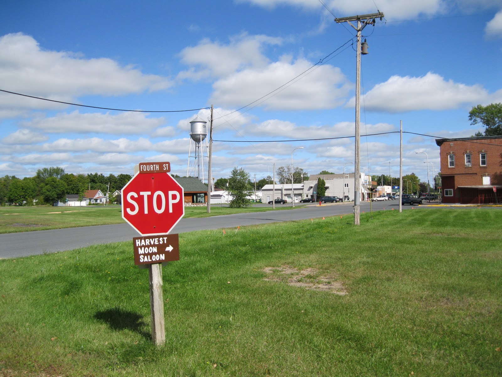
Just get ready for the steep hill you must climb up to where the actual rail bed starts.The trail is off the east side of the parking lot, and is paved for just over a mile. I was spoiled by the smooth ride, and thought I'd be spoiled for the rest of the way, but no. It does turn into screened limestone, and is still in fine shape.
It follows a quiet street for just a few blocks, but then crosses to the north and becomes its own trail again. It's easy to follow.
After the steep hill and going past an industrial area, it's on to the main bike trail that goes on and on and on.
This was the first time I had encountered "belting". That's the rubber belt going down the middle of the trestle. It's for a smoother crossing with your bike, and no getting caught in the cracks between boards if the boards are running vertically rather than diagonal or horizontal.
This stretch has a mix of woods and farm fields, and judging from the tall cypress seen in the distance, a cemetery.
After 4.5 miles, Centuria appears. The trail borders the west side of the main area of town, and you can easily get to the main street where you'll find the usual small town Wisconsin businesses.
If you don't want to hit Main Street for a restroom and refreshment, there is a very nice trail station here to use.
You'll never be far from highway 35, so you'll never feel lost, but you'll always hear traffic along this leg of the trail. I prefer NOT to hear traffic. There are advantages and disadvantages to this, and you will find out what the disadvantage is when I report on Leg #2 of this trail. (Foreshadowing! Spooky!)
6.2 miles goes along quickly, and then Milltown.
Oh, Milltown, you tempted and then disappointed me. I really wanted what you had to sell, but I couldn't get it! Waahh.
The trail crosses through Milltown's center. I biked west along Main Street to this little establishment hoping for a cold coffee drink, but Julia had closed up for the season. Or the day. Who knows?
But then I saw THIS, and that's what I really, really wanted! It looked pretty exciting too, with all the exclamation points, same prices for THREE YEARS IN A ROW! I was salivating. It said NOW OPEN!! And the neon light said "open".
It wasn't open. I felt low.
I sat at a picnic table in front of the Milltown Drive-in and had a granola bar and water. No enjoying 19 flavors of ice cream for me. Then back to the trail.
Libations are everywhere. See? Bike trails are good for business. Just build the trail, and they will come.
Multiple signs along the way will point out where all the towns are. What I missed seeing are historical signs. There aren't any.
After Milltown, and 3.7 miles, you are in Luck. Ha. They don't let you forget how lucky you are, either.
Just in case you didn't know.
Oh, there's more, but you get the idea. There's a theme going here. I liked the downtown of Luck. The trail runs just along the west side of it, the main street is only a block off the trail, and there are a number of choices where you could spend time and money. I chose to use the restroom in the new and very nice public library, which is also on Main Street. I also picked up a refreshment in the natural foods store, (good one) just a half block from the library.
Luck was the end of Leg #1 of the Gandy Dancer State Trail. I turned around and pedaled back for 14.4 miles, and then I was..............you know it.............out of Luck.
Trail information contact: Wisconsin DNR,
Polk County Tourism, Polk County Parks, Trails From Rails.
Trail head location: St. Croix Falls, Wisconsin (Polk County Information Center) south of the Highway 35 and Highway 8 intersection.
Length: 47.1 miles (but I did "Leg #1" section from St. Croix Falls to Luck at 14.4 miles and then doubled back).
Usage: (Summer) walking, biking non-motorized. (Winter) Cross-country skiing (untracked?) snowshoeing and snowmobiling (if 6 inches of snow).
Highway crossings: Small roads, mostly in the towns. Highway crossings have trestle bridges or tunnels.
Surface: Limestone screenings.
Scenic: Pleasant.
Signage: Well marked directional and mileage signs. Missed the historical information though.
Regional trail system: Yes, cooperates with Minnesota. It sort of is its own regional trail system, being so very long if you count the northern section from Danbury, through Minnesota, then back into Wisconsin up to Superior. In the future, it may be linked with the Stower Seven Lakes State Trail that I previously reported on. That runs From Amery to Dresser, which is about 4.2 miles from St. Croix Falls.
Rest stops: Polk County Information Center (St. Croix Falls), village of Centuria (and a very nice rest stop in Centuria), village of Milltown (toilets at Anderson Field too), village of Luck (like the library rest rooms!)
Those are the facts, Jack. The trail is in very good shape, and the steep hill to get up to the rail bed (main trail line) just means that if you are going back again, like I was, you have a free ride to your car. And be sure to stop somewhere in Luck. Maybe you'll get lucky.
Mantra: Keep on pedaling and no bears.


Nice report! I loved the photo of the library building.
ReplyDeletePeace :)
Thanks, Chandra! There will be two more posts in the future on two more bike trails that I did during "biking season", so "stay posted"!
ReplyDelete(Even better photos coming, plus some excitement with nature.)
Keep pedaling,
Janet